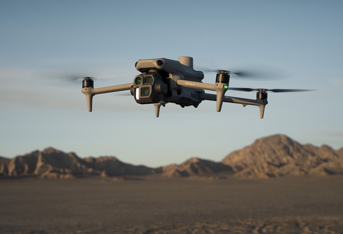





Why Urban Planners Are Switching to 3D Mapping Drones
Urban planners are turning to 3D mapping drones because these tools can survey large areas in a fraction of the time required by manual methods. What once took days or weeks can now be completed in hours. Drones equipped with high-resolution cameras and LiDAR sensors generate highly detailed maps, 3D models, and geospatial data. This level of precision supports better planning and reduces costly errors. In fact, 3D mapping with drones enables the creation of digital twins, which are virtual replicas of urban environments that allow simulations for infrastructure development. This article explores the limitations of traditional methods, the key advantages driving this shift, how 3D mapping software for drones transforms urban planning, and practical applications in urban development.
The Limitations of Traditional Urban Planning Methods
Manual field surveys dominate traditional urban planning, but their shortcomings have become increasingly apparent. Transportation departments face significant challenges with data collection methods that demand substantial time and financial resources. Field crews physically measure features using radar guns and measuring wheels, which proves both expensive and slow. Sidewalk inventories alone cost between SAR 300 to SAR 3000 per mile to complete. Large agencies spend tens of thousands of dollars and hundreds of staff hours on such surveys.
The dynamic nature of cities creates another obstacle. Data becomes outdated while collection is still underway. New developments might emerge on one side of town before teams finish surveying the other end. Decisions often rely on stale information that fails to reflect current conditions.
Coverage gaps and human error compound these problems. Field crews might skip low-traffic streets or overlook minor features. Different surveyors classify conditions inconsistently, and transcription mistakes slip through. Important measurements get omitted, leaving blind spots in datasets.
Traditional 2D maps add their own constraints. They cannot represent elevation changes or terrain complexities in visually intuitive ways. Users struggle to interpret abstract symbols like contour lines. These maps also offer limited interactivity, restricting viewers to fixed, top-down perspectives that reduce engagement. The result is a planning process that cannot scale to meet modern needs.
Key Advantages Driving the Switch to 3D Mapping Drones
Speed stands out as the primary driver behind adoption rates. A drone can survey 100 acres in less than an hour, while traditional methods require days of fieldwork plus additional processing time. Projects that once demanded 2-4 days of ground surveying now reach completion within 4-8 hours from flight to deliverable. Field time drops by 60-80 percent according to industry productivity studies.
Accuracy matches or surpasses conventional approaches. 3D mapping drones equipped with RTK technology achieve centimeter-level precision, with some configurations delivering sub-5cm photogrammetric accuracy. When RTK systems combine with Ground Control Points, measurements reach millimeter-level tolerance.
Cost reductions follow naturally. Operational expenses decrease consistently across projects, with fewer personnel required in the field. One contractor eliminated five man-hours per site visit by replacing manual inspections with 15-minute flights. Labor requirements shrink substantially, cutting travel costs and deployment time.
Safety improvements remove workers from dangerous environments. Drones access steep slopes, remote locations, and hazardous sites without exposing survey teams to risk. This capability reduces accidents while maintaining regulatory compliance.
Data integration capabilities cement the transition. The 3D models generated through 3d mapping software for drones fit directly into BIM workflows and work seamlessly with various GIS platforms. Teams can visualize geo-referenced data immediately, enabling timely adjustments without compatibility issues.
How 3D Mapping with Drones Transforms Urban Planning
Photogrammetry technology converts overlapping aerial photographs into detailed 3D models that reveal elevation data, building heights, and terrain information necessary for informed development decisions. Modern drones equipped with advanced sensors create maps with centimeter-level accuracy, delivering precise measurements that rival traditional surveying methods while covering significantly larger areas.
LiDAR-equipped drones take precision further. Light Detection and Ranging sensors penetrate vegetation canopies and create precise topographical maps even in heavily forested urban areas. This capability proves invaluable for projects requiring elevation data, such as flood mitigation planning or utility infrastructure placement. City planners can identify elevation changes across urban areas, assess potential drainage issues, or optimize solar panel placement for maximum efficiency.
Multi-temporal mapping represents a significant advancement in urban analysis. Repeated surveys of the same areas allow planners to track changes over time with remarkable precision. Urban growth patterns, infrastructure deterioration, and environmental changes become quantifiable rather than subjective observations.
The integration of 3D mapping with drones into digital twin systems enables real-time updates. After natural disasters, drones rapidly assess damage and update digital twin models, enabling authorities to plan recovery efforts efficiently. Similarly, the combination of real-time drone data with historical and environmental data supports predictive analytics, forecasting traffic congestion, infrastructure wear, or environmental impacts of urban development.
Practical Applications of 3D Mapping Drones in Urban Development
Site surveying represents one of the most impactful deployments of 3D mapping drones. High-resolution aerial datasets enable planners to evaluate land suitability, assess development constraints, and simulate multiple design scenarios before execution. Unlike satellite imagery, which faces resolution or revisit cycle limitations, drones provide on-demand data capture tailored to specific project needs. During master planning, drone data supports site selection and land-use optimization, while execution phases benefit from aerial monitoring that ensures adherence to design intent and regulatory compliance.
Infrastructure inspection has transformed through drone applications. Bridge components can be examined from multiple angles without requiring lane closures or putting inspectors at risk. High-resolution imagery reveals crack patterns, corrosion, and structural defects. Multi-story buildings undergo thorough facade examinations without scaffolding or aerial lifts. For those considering implementation, contact Abdulrahman Alshareef Group or visit our website to choose the right drone for your business.www.alshareefgroup.com
Public participation processes gain new dimensions through aerial imagery. A simple 5-minute fly-over video of an urban neighborhood at multiple elevations may reveal both empirical and experiential observations, including the diversity of housing types, underutilized open space, traffic patterns, natural systems flow, community activity nodes, or light cast over the neighborhood at sunset. Conceptual overlays of proposed conditions can be integrated into three-dimensional aerial video, adding spatial and temporal dynamics to the design process.
Conclusion
The shift from traditional surveying to 3D mapping drones brings measurable improvements in speed, accuracy, and cost-efficiency to urban planning. Photogrammetry and LiDAR technologies deliver centimeter-level precision while covering vast areas in hours rather than days. These advantages translate directly into better site surveys, safer infrastructure inspections, and more engaging public participation processes. Urban planners ready to adopt this technology should contact Abdulrahman Alshareef Group or visit to choose the right drone for their specific project requirements.www.alshareefgroup.com